These days, when we drive, we barely give a thought to figuring out how we’re going to get where we’re going; we just program our GPS. Some of us still like to have physical maps to back up the satellite navigation service, especially in remote areas with spotty service, but GPS has become our primary navigation aid. Pilots still need to give it more thought, but GPS entered their tool bag beginning in 1994 and has now become the dominant navigation aid.
Back in the early days of aviation, however, navigation was a huge challenge. There were no maps designed for pilots; the first airmail pilotsfollowed the “iron compass” – railroad tracks – to find their way from city to city. They could only fly during the day, because they needed light to seethe tracks. Even when the Army Air Service and the U.S. Geological Survey began creating “strip charts” in 1923 to plot airway routes between locations, including shortcuts over places rails and roads couldn’t go, pilots needed to be able to see the geographical features on the charts to be sure of where they were. For airmail to be a success for the U.S. Post Office, however, it had to be faster than trains to make the higher cost worthwhile – and trains could run at night. One experiment with bonfire beacons along a route between San Francisco and New York in 1921, with pilots equipped only with a railroad map and a compass, was enough to demonstrate that they wouldn’t be reliable, although one plane managed to complete the flight in 33 hours and 20 minutes, beating railroad time.
Serious experiments with small beacon lights in summer 1923 between Dayton and Columbus, OH succeeded in regular night runs, and a permanent chain of bigger lights was established in 1924 between Chicago, IL and Cheyenne, WY. By July 1925, light beacons defined an airway running between New York and Chicago. That success, and the passage of the Air Commerce Act in 1926, jump-started beacon construction, overseen by the Department of Commerce, and airmail airways began to crisscross the country with beacons on towers ten to fifteen miles apart, able to be seen for about forty miles in clear weather. The airway beacon system was at its peak from 1941 to 1946,with 2,112 beacons along 124 airways in the US.
Of course, the light beacons couldn’t reach through or above clouds, and radio-based navigation, developed during WWII (the VOR – Very High Frequency Omnidirectional Range system), rendered the airway beacons obsolete. The US Civil Aeronautics Administration (CAA, forerunner of today’s FAA) began to deploy VOR in 1949, and as the VOR network developed and spread through the 1950’s and 1960’s, the old airway beacons began to be decommissioned. Airports still have beacons to provide visual identification of the airport to pilots at night, but the very last federal airway beacon shut down in 1972. With the rise of GPS, the VOR system itself is being cut back simply to provide a conventional backup navigation service in case of GPS outages technology marches on and history rhymes.
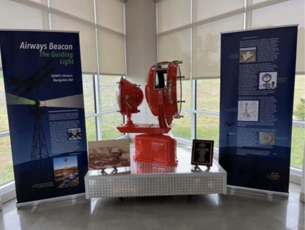
So why am I talking about a system that no longer exists? Because a piece of that crucial aviation history unexpectedly turned up at Warrenton- Fauquier Airport and has now been transformed into a marvelous historic exhibit in the terminal building, dedicated on April 25, 2026!
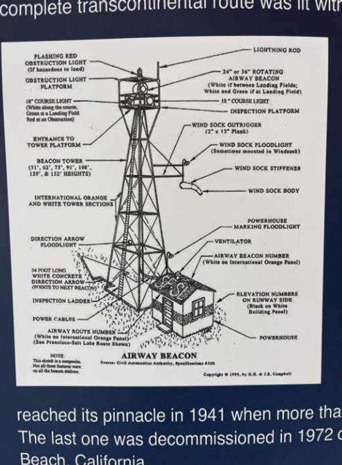
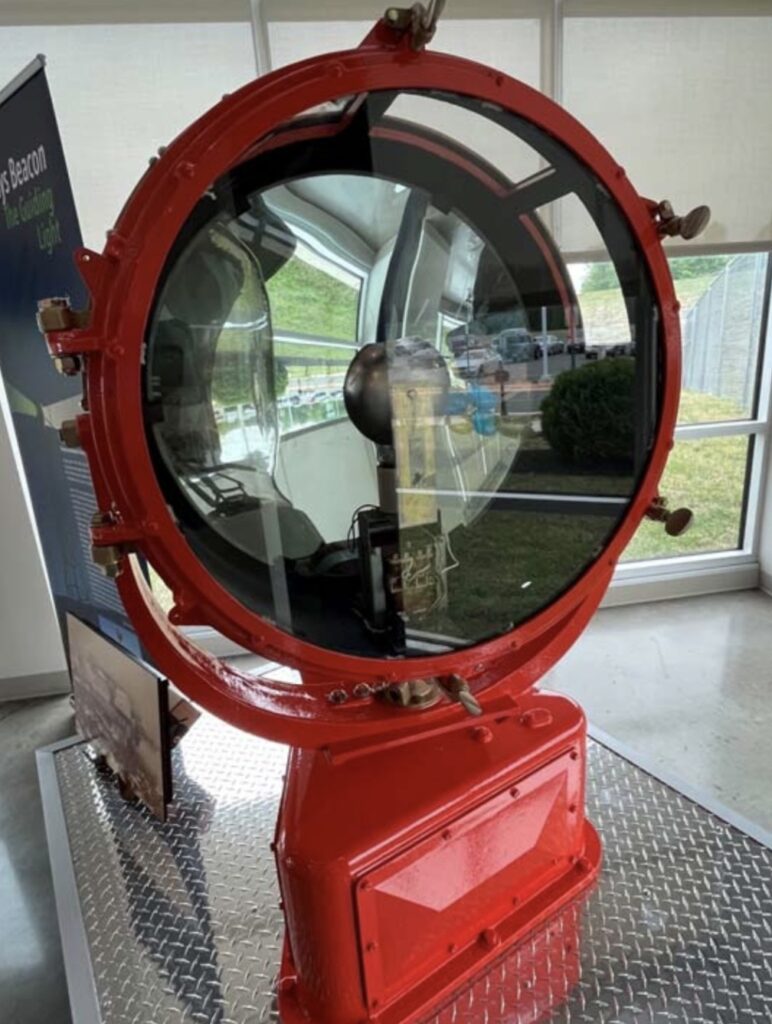
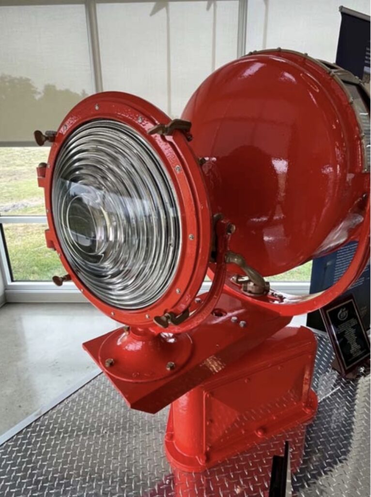
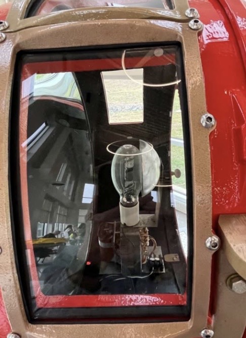
Warrenton-Fauquier Airport didn’t exist during the heyday of the beacons, so it wasn’t a stop on the airway beacon system. It began as a little grass strip in the 1960’s, got popular, expanded and got paved, and was purchased by Fauquier County in the late 1990’s to be operated by the county government. Along the way, it acquired a second- hand beacon light to use as its identifier. That rotating white and green light served until 2013, when the FAAjupgraded all airports to LED lights.
When the folks at Warrenton took down the old beacon – thankfully with great care – they discovered it bore a Department of Commerce Airways emblem, signifying it had once been part of that historic airway beacon system. The Warrenton Booster Club, with the help of volunteers and donors, undertook the restoration of the beacon. They still don’t know where it had been positioned back in the day, but the research continues; I’m hoping they can trace its full provenance and fill in the blanks!
So, the next time you’re at Warrenton – say, at an upcoming Young Eagles rally – check out the lovely new display and read all about the beautifully restored beacon. It shines a light on our
aviation past!